Thursday, October 17, 2013

Day 13: Lincoln Peak to Cooley Glen

I was up and out of my sneaky storage-hut campsite bright and early, stepping outside into a world of windy fog. Mount Abraham has apparently some of the best panoramic views of the entire Long Trail. Not for me, today:


It's OK -- I can come back here another time. I started the descent, and the fog started breaking up into little whizzing clouds. I'm not exaggerating -- they were whipping across the new blue sky about 5ft above my head, as I inched carefully down over massive boulders. It was a bit dizzying to look at the clouds. So I looked at the trail and practiced "the old sit and slide" down the rocks (so said the hearty lady GMC caretakers heading north up the mountain). My pack is still reasonably heavy, and it's like extra gravity at my back. 

I stopped at the next GMC shelter for my Abe Kendal Mint Cake. The sugar had frozen into appropriate little cloud formations.


A couple of hikers from BTV offered me left-over hot choc and I plodded south happy with a warm sweet waterbottle and a belly full of KMC. Lots of dayhikers and dogs were out on the trail, including a barefoot hiker. My boots are still blocky and rigid and I'm having to remind myself that most of my favourite things were not immediately comfortable or amazing. 

I cross the Lincoln Gap in hot sunshine, and head on up to Sunset Ledge. People are sitting with sandwiches and dogs, soaking up the view. I sit on the rock, and a Pointer-Greyhound cross comes over to perch on my lap. I'm absurdly grateful for the quasi dog-hug as I chat to her owner. "Are you alone?" asks this grey-haired lady. "Good for you!" she cheers -- "I camp alone, too. I do what I want. I'm an American woman!" She thinks I'm Canadian. Ha. The dog snuggles to my side, probably hoping for snacks rather than camaraderie. I get going, bumbling off through the trees. "Sweetie!" yells the lady. "I think the trail's the other way -- where there's a white mark". She's right.


Now I'm in the Breadloaf Wilderness. The terrain isn't super tough, but the miles kind of stretch. I snack at the top of Mount Grant and quite quickly arrive at Cooley Glen shelter. It's around 4.30pm, and more than five miles to the next shelter. So I decide to stay put, staking out a corner of the open-face, ground-level lean-to. A couple of ladies show up, older than me. They have all kinds of cool gear solutions -- Urck bear-bags that are somehow impenetrable to bear teeth and claws, and  super-light dehydrated food (eg, hummus flakes). They're a couple of days into a sectional hike, after a false start when their hiking buddy fell and broke her upper arm coming back from the privy at Skylight Pond. Ouch. Apparently she was looking at the view rather than concentrating on her foothold.

"Have you read that book Wild by Cheryl Strayed?" asks one of the ladies. We mutually gush about how totallyACE the book, and Cheryl, are. "Why do you like doing this?" asks the other lady. It's a question I don't have a ready answer for, I'm still working out why I want to do this hike. At this point, though, I'm sure I do like the LT, and that it will somehow be mysteriously beneficial to me this year and beyond.

We line up our sleeping bags with toes to the woods, and wait for the predicted overnight storm. I'm woken up when a northbound hiker headlight-sweeps the shelter and decides to carry on in the rain. The ladies wake up when their corner of the shelter starts leaking.


Wednesday, October 16, 2013

Day 12: Appalachian Gap to Lincoln Peak

A few days at home -- laundry was done, non-Ramen food was eaten, bed was slept in. I did some grinding low-level freelance writing to pay for new boots, and opted for the Mammut Teton GTX lady-boots  that were clearanced at the OGE. They weren't the most comfy, but on the little paving-slab-crumbled fake hill they gripped the best. After my experiences on ole Mansfield, that was what I wanted. 

I wore my new boots to a house concert in Lincoln, where a small and sweet audience gathered to watch me hit flowerpots in the living-room. The phrase "avant-garde" was thrown around a fair bit. The next morning, climbing south away from the Appalachian Gap with a tight roll of banknotes from the house show in my pack, I felt like my own advance guard -- pushing south ready to make the new things I needed out of what I was carrying. 

The trail seems kinder here than in the north -- there's more moss and less jagged rock, and metal rungs are secured in the biggest boulders and cliffs. The rungs sing dull, stingy pitches when I thwack them with a metal hiking pole, a sullen, sturdy gamelan in each cliff face. This is how I steadily climb up to the ridgeline, where the trail flutters over a whole series of peaks before Mount Abraham. Chairlifts are a recurring theme today: 


I meet a group of lady hikers in nice, clean clothes. I take their photo and they are keen to reciprocate. 

Good posture and normal facial expression are mutually exclusive. 
The ladies are planning to camp overnight at a ski warming hut, then go home. The warming huts are not "official" LT shelters, but apparently it's OK for hikers to sleep in the open huts. I stop for lunch at Stark's Nest, a hut that Mike-with-the-dog  had recommended as one of the best sleeps on the trail. I'm planning to go further today, maybe on past Mount Abe, or maybe stop on one of the earlier peaks where the ladies said there was a warming hut. I think they said they were staying on Lincoln Peak.


C. Hump, I'll be coming back to climb ya. 


Mount Ellen has another chairlift:


I just basically piddle along up and over multiple peaks in the ridgeline. My new boots are rigid and the balls of my feet sting. My big toes are numb again, but I'll take that any day over the fractal blisters I  had on the Coast to Coast hike. 

I have my headlamp ready and a surfeit of spare AAA batteries, and I'm thinking I could hike over and down Mount Abe after dark if necessary. Last night, around the post-concert bonfire, a mightily-bearded gent was talking about night-kayaking alone on Lake Champlain, heading across to the New York side for dinner. In the dark, he fell out of the kayak and couldn't get back in. So he swam the kayak to a place on the shore that he'd once seen kids cliff-jumping -- he knew that meant there was a way to scramble out of the water at that point. Buoyed by this story, I wasn't so frightened of hiking in the dark as long it was dry. 

I get to Lincoln Peak just before sunset, and see a massive hare steering in and out of the trees. 


Towards NY.


Despite my massive and sturdy shadow in this photo, I was feeling pretty knackered by this point. I thought I'd just find the warming hut and camp with the ladies for tonight. Poking around the summit, I found a (locked) electrical works hut, an open pine-plank summit platform, the massive hare again, and a chairlift:


No warming hut. I walked a way down some ski trails, no luck. I realized that the warming hut I'd passed a couple of miles north of Lincoln Peak was probably the one the ladies were staying at. Oops. The wind was picking up, and I thought pitching the Megamid on the summit platform would likely make for a chilly night. 

So I did a sort of naughty thing -- I slept in the storage hut under the chairlift. I swept up some of the scattered trash, and moved the little mini-couch over to make a sleeping mat space on the floor between a hard wooden bench and the upended ski-rescue sled. 

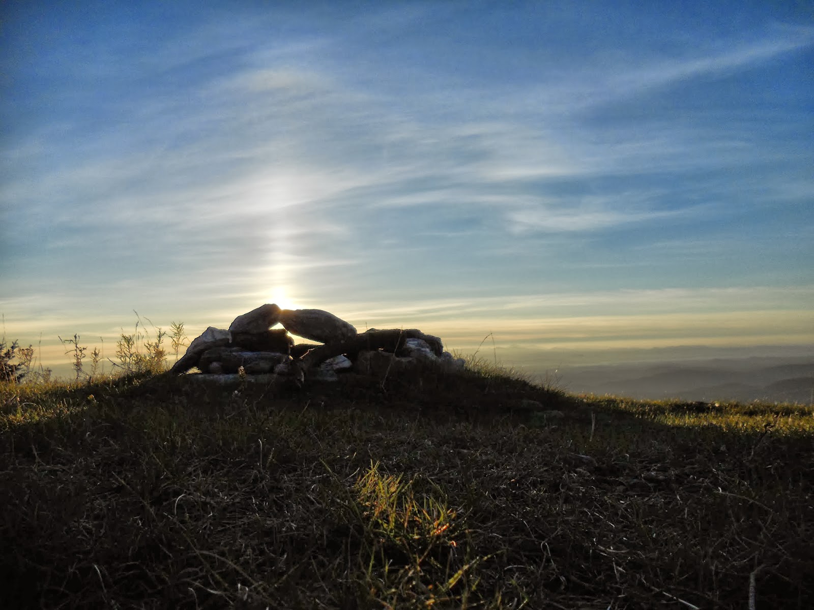
Took some summit-sunset pictures that don't capture the blazing glory over the Adirondacks:


Through the window of the storage hut, a massive red full moon rose; at the end of the ski trail lights twinkled in the valley. 


This was perhaps the most solitary I've been on the trail. I was very grateful for the hut's four walls and closing door as the wind picked up and whipped the summit. I nestled down in my sleeping bag and my mittens, and slept until I was woken by the sound of a Massive Creature In The Hut. I'd heard creaturely rustlings outside at dusk, but this rustling and gnawing sound was loud and close. With my pulse up in the pop-punk BPM range  I shone my headlamp gingerly around the dark hut. Table, overflowing trash can, padlocked metal locker askew in the middle of the floor, "No Whining" sign, maps with four-digit codes for the top of each ski run, roll of industrial paper towels... no marauding creature. I laid back down, wide-eyed, until the rustling and gnawing started up again. By now I'd decided it was an evil rabid possum-raccoon-fighting porcupine, chewing through the hut with the express purpose of eating my face. I put my headlight back on. The gnawing didn't stop -- the creature was obviously getting bolder. Behind the locker, I saw the paper towels move. A tiny grey mouse was chewing up the paper to make a nest, and the movement of the stiff paper made the sound. The mouse and I stared each other down for a while, and I felt foolish for being terrified of a creature the size of my thumb. I was in the mouse's house, after all. I went back to sleep and the mouse went back to taking care of its business. In a way, I was glad not to be totally on my tod on top of an inky-dark mountain. 

Saturday, October 12, 2013

Day 11: Mount Mansfield to My House

I didn't write any notes or take any photos this day. Nonetheless, it's one of the most memorable on the trail. I climbed Mount Mansfield in peeing rain and blowing fog, shivered along the ridge, trundled down the Toll Road and went home.

Originally, my plan had been to walk to Route 17 south of Camel's Hump (in the next few days), then get picked up for a laundry break at home before walking Route 17 to Massachusetts. It was already clear by Day 11, though, that I'd been wildly optimistic on the daily mileages I could cover, in daylight, with a rather heavy pack. The mid-hike laundry break plan was a concession to both the concert schedule as it panned out, and to my beloved -- neither of us wanted me to be away from home for a solid month. 

By this point, it was clear that I couldn't cover the mileages I'd cribbed off this guy's southbound LT hike. Literally, in the last-minute rush of getting the grant and planning my own trip, I'd just pasted his mileages into a spreadsheet and arranged them around the concerts that were lining up. I knew it was unlikely I could match this guy's pace -- he was a 20-something, tallish veteran of the Appalachian Trail. I'm a stumpy 30-something backpacking novice, and for many reasons I was not willing to routinely hike at night (as Speedy McSpeedPants did -- he climbed Mount Mansfield in the dark). 

So, excuses-excuses, I'd realised I was going to be left with a mid-hike gap to come back and fill in after the end of the tour. This was going to be a sectional hike rather than a true through-hike. That was totally fine with me -- one of the reasons I chose the Long Trail as my first long-distance trail to complete here is that it's local. If the weather or my physical condition got overly dangerous at any point, I could always skip part of the trail and come back later or next season. I will complete the trail; it doesn't all have to happen right now. 

And you thought this blog would be meme-free.

So, back to Taft Lodge. It was still raining, view was nil. I filled my water bottles after a slip-slide over boulders to the brook. All my hanging soggy clothes were still hanging and still soggy. In particular, my trusty M&S sports bra was completely saturated with just-above-freezing-temperature water. With my last dry T-shirt and a selection of sailing knots, I crafted a minimally-supportive boulder holder. I was pretty pleased with my craftiness, and told myself that the minimal support was fine. After all, I wouldn't be doing any running today (*note, I was wrong about this). I layered on the rest of my claggy spandex and waterproofs, jammed my feet into my sodden split-open boots, applied more duct tape, and started the climb up boulders, cliffs and ledges to the summit. Grey morning mist was swirling around, and the views were zero. Water rushed noisily in bursting brooks, and down the trail itself. I accepted wet-foot saturation, and walked on the flattest boulders in the stream. I tried to always have three points of contact with the trail, using fingers, elbows, knees and the toes of my boots where there was no duct tape on the sole. I felt like a tiny thing literally crawling up into the sky. Well, a tiny thing with a massive backpack. The trail looked like this (not my photo), but wetter and foggier: 

from tripleblaze.com

Imagine this with streams of water coming down the trail, and you understand the merry hour or so I spent heading toward the summit. Then... I came to this:

from redbubble.com: "turn left at the cliff". 

There was no blue sky, or view, for me. Just a blanket of thick grey fog that was blowing hard against me as I approached the cliff on the left. Down which, torrents of water were streaming -- a ledge about 15ft up made a little waterfall that landed on my face as I looked up the cliff and wondered if this was where going southbound became impossible. I collapsed my hiking poles, strapped them into my pack, and looked for handholds and footholds on the cliff. I took one shaky step, and the sidewind pushed me to my left, knocking my two-litre water bottle out of its bungee-cord nest. I stepped down, repacked the water bottle, put my wedding ring in my secret zipper pocket, and just barely talked  myself out of totally losing my nerve. I talked, out loud, to myself as if I was an almost-panicking child, or a sheep that doesn't see the gap in the wall it's being driven toward. "It's OK, you can probably do this", I told myself. I reminded myself that I'm only the most recent nerd to be attempting this trail -- people do it all the time, and have been doing so for over a century. I'm not that special.

A friend whose opinion I value highly told me, the day before the trip, that the opposite of fear is faith. I'm going to say I got up the cliff on 51% faith, 49% fear. I had just enough faith -- or trust -- in my own muscles and the sturdiness of my pack to stay with me, and my plan to fall on the pack if I had to fall, and all the friends who believed I could do this mad hiking tour, and my really-not-wanting-to-go-back, to make it. My whole body was shaking, and not just with the cold. I had no other thoughts in my brain than getting up the cliff. I took off my hat and hood, because (as a small boy would tell me a few days later), it's hard to climb a tree -- or a cliff -- when your hat blocks the upward view. I turned my face into the waterfall that was still tumbling indifferently off the ledge, and clung to unlikely holds with fingernails, forearms, shins and curling toes. The wind caught my backpack's raincover like a sail, and I clung closer to the cliff against the sideways pull. My waterbottle blew free again, and swung like a pendulum in the bottom of my raincover. Instinctively, immediately, I threw a backwards punch at the waterbottle; it tumbled down to the ledge and I apologised to the principles of Leave No Trace as I kept inching up the cliff. 

from meetup.com. I'm pretty sure this is the part of the trail I'm talking about. Imagine it with a honking great pack, angry fog and a hefty sidewind...
And then, I'd made it. I heaved myself up onto the ridge, got my hiking poles down from the pack, and started picking my way along over boulders to the summit. Thick fog was still blowing, the whole scene was lonely and whistly and eerie and vaguely reminiscent of the "road to nowhere" in Crash Bandicoot: 

The only video game I've ever spent significant time playing. 

Here's someone else's photo: 

from trevstripreports.blogspot.com
My plan had been to walk the Long Trail south as far as Butler Lodge, then head down the side trail to Underhill. I passed over Mansfield's summit -- Vermont's highest peak -- chilly and somewhat indifferent, and picked my way along the ridge to the summit station at the top of the toll road. A hearty GMC caretaker was on duty -- I asked how scrambly the trail to Butler Lodge was. He said it had as many cliffs as the trail I'd come up, and opined: "I wouldn't do that trail in the rain with a big backpack". Correctly estimating my technical-trail skill to be many levels below the caretaker's, I decided to go down the Toll Road itself -- 4-and-a-half miles of dirt road down into Stowe. I thanked the caretaker, handed in the gentleman's watch I'd found on the LT just below the last cliff section, and didn't mention my abandoned water-bottle. I walked a few yards down the toll road, out of site of the summit station and the car park. I ate my Kendal Mint Cake for Mansfield. It was amazing. I set off downhill, amazed at being able to walk normally on a steady surface without boulders, roots, running water, bogs or mud. I got excited and started to run, backpack and poles and all (*note: here's the bit where I was wrong about running and the viability of my homemade sports bra). I stopped that silliness when I came across a retired couple out walking the ski trails. They were clean and fit and well-equipped, not heading for the summit but just out walking around. I felt awkward in my soggy filth and my torn-up thrift-store waterproofs, but we chatted all the way down the Toll Road as their altimeter beeped every few seconds. They cut out on a ski trail and I raced to the toll gate, feeling mighty and powerful on my still-sodden, numb feet and pitiful boots. I was almost an hour early for my pick-up, but that was OK -- hiking is teaching me to be patient. The toughest part is in the bag .

Thursday, October 10, 2013

Day 10: Sterling Pond to Taft Lodge

My plan had been to get up and over Mount Mansfield today, but after seeing lightning actually strike the ridge yesterday -- and today, my phone says there is a 100% chance of thunderstorms by the mid-afternoon -- I've decided to stop short at Taft Lodge and summit Vermont's highest peak the following morning (when it apparently will be wet but lightning-free). 

My boots, at this point, are pretty much done. I'd hoped they'd last the Long Trail, but both boots are now split open on both sides -- passenger and driver-side "doors" hanging open, funnelling water and bog directly to my toes. I tape my boots up again, aware that the tape only lasts a few miles, and reduces my grip significantly. 


I fill my water bottles from the pond. I'm sad to leave it.


These purple flowers pop up a lot near ski areas. I have no idea what they are. 


It's slow going on wet boulders, mud and roots. I slip a couple of times, but have yet to really properly fall. In no way can I afford a broken ankle at this point; I'm extra cautious. Oh, and slow. We already established that. 

It rains the whole way down into Smugglers' Notch. 


I'm not cold, though, because of the effort. I've a wicking t-shirt and balloony red trousers that I'd assumed were waterproof (predictably, more on this assumption later...). The trail mostly tunnels through woods, so the rain isn't necessarily falling on me most of the time. As I walk, frogs leap for the safety of puddles. The smallest is the size of my fingernail, the largest the size of my fist. 

During the steady and long descent to the Notch road, a tiny orange lizard-gecko creature is panicking. All fingers and toes, he's trying hard to get away from me, but slipping on the muddy trail. I stop, and say out loud: "Don't worry -- just choose where you're going and I'll go the other way". The lizard scuttles left, I step around to the right. Realise I've just attempted a conversation with a lizard. 

My heightened creature-empathy means I don't take a photo of the big, beautiful frog I see while I ford the stream into the notch. The frog hops into the water, and swims away to hang onto a twig. It would be a good photo, but I can see the frog is stressed out -- I don't want to add to that. How very Buddhist.

In the soggy Notch I take a break, chew on some jerky and scoff my second Fruit'n'Nut of the day. Then there is nothing else to do but start the climb up to Taft Lodge. I sign into the LT south on the other side of the road, and tell myself "this will just be horrible for a while". The ascent was alright to start with; then the rain started pelting down, hard. I kept going, with the water troughing and stinging my eyes. By this time I was soaked (the red trousers proving water-resistant rather than waterproof) and it was too late to put on my waterproof jacket. At least the downpour stopped me from taking my usual oh-climbing-hills-is-hard breaks every few minutes. Higher up, the trail was awash -- basically, I was scaling boulders in the middle of a temporary stream. I got to a saturation point, boots full of water, and climbed upstream largely using my soggy knees for traction; the pack's weight pressed me down into the stream. The two miles up to Taft Lodge took me around three hours, a rather pathetic pace. Multiple times, the ascent went from awful to bearable to sort of dream-like. Climbing a river in a cold shower.  

Then I'd arrived -- the rain stopped, I took off my boots and sock-ponds and my not-quite-waterproofs, and watched sun patches slide around the valley while different layers of clouds gathered and dispersed. The creamy clouds were disappearing into the grey clouds, and patches of grey were visibly being drawn upwards into the hovering grey blanket. It was sort of the opposite of watching for a tornado spout. 


Taft Lodge is amazing. It's a log-cabin kind of thing, with a door that closes and loads of space. With only 5 people in the lodge including myself, I had a whole 6-person upper platform to myself -- the GMC caretaker referred to this as a "penthouse suite". I appreciated the space, and took over all the hooks in my quadrant, hanging up my soggy fabric with hopes it would dry by the morning. I turned on my phone, and dealt with a few booking enquiries for the autumn and spring. Hustling for gigs is a significant part of my work, and I'd worried about being away for the month. But it seems that booking can be like a wild dog -- sometimes you need to just walk away, and the dog will come to you. It's not necessary to be running towards the dog and yelling all the time.  I don't have to be constantly pushing bookings 52 weeks of the year. I'm on a Zappa tribute show for early 2014. Yeah.

Day 9: Bear Hollow Shelter to Sterling Pond

"This is what I do now", I kept telling myself through the long, long, rocky, sticky, humid climb up Whiteface Mountain. I ate a single, precious bag of salt-and-vinegar crisps before reaching the no-view summit. I crossed paths with a lady going north -- she had one foot in a sandal, the other in some kind of plastic bag. She was moving faster than I was. We chatted a little, and I noticed that once again my voice was croaky. This trip involves a weird combination of not speaking to anyone from one day to the next, and then using my voice a lot in the concert-presentations. 


I'm memorising music and words as I walk, but not speaking them out loud because that would use my voice and make me thirsty and therefore I would have to carry and drink more water. Also, because it would make me sound like a weirdo. 

It's slow going today -- the trail is boulders, up and down over multiple mountain summits. At the top of Morse Mountain, the trail feels particularly exposed and arbitrary -- I sit-n-slide down boulders among little weather-battered trees. I start up Madonna Peak, and meet a gentleman with (I think) a southern-states accent. "Another conundrum", he says, resigned, as he slowly splays backwards down boulders. Dealing with this terrain, I've generally learned to take my mother's advice to me as a child: "go down backwards if you need to, take small steps on stairs". I descend boulders backwards like a ladder; I sidestep, I crawl. 

There's a storm coming in, and I'm trying to get up and over the Madonna peak before it breaks. I'm tired, and sticky, and rather grumpy at this point. I push up the last bit of ski trail to the summit, where the clouds are ominous and almost close enough overhead to touch. Layers of blue-white-pink-grey clouds are swirling and re-distributing themselves; I want to take a picture but am urged off the summit by the gathering wind and the instinct that those clouds will soon stop dancing and start spewing. I can see Mount Mansfield over the other side of Smuggler's Notch -- as I'm watching, a needle of lightning shoots out of the sky and strikes Mansfield's ridge. This is a timely reminder for me to watch the weather and be careful. 

It's slidy-downhill to boggy-downhill to, just before dusk, Sterling Pond shelter. I've been here before on day-hikes and I love it. I dump my bag and my boots, and head down to the pond in my flip-flops. 


This is one of the most beautiful places I know. While I was basking in the beauty, aggressive (and massive) dragonflies like angry helicopters buzzed and circled me, trying to see me off their watery turf. 

I'm the only person in the shelter, and for once I'm too warm in my sleeping bag with amazing-merino-sister-top, two fleeces, hat and gloves. I nix the fleeces, and sleep early. Then around 10pm, I'm woken up by the most massive, violent storm I've ever heard. Rain hammers on the metal roof of the shelter like a snare drum; thunder booms like a mile-wide bass drum and the lightning crashes are more of a china-cymbal white-noise sound. At first, my instinct was to curl up with my spine against the storm, protecting the soft parts of myself in case the shelter broke under the battery of the storm. Then I realised it was too loud to sleep anyway, and I could enjoy the storm's percussion under the sturdy (and amazingly, leak-free) shelter. I lay on my back, toasty and dry, listening to the loops of thunder and lightning, the polyrhythms of the rain, and the slow onwards journey of the storm system.